
(Logan Finney/Idaho Reports)
This week, we’re bringing you a snapshot of the water supply in Idaho from the Governor’s Water Summit, where water users and policy makers gathered at the state capitol to discuss water issues. Idaho Department of Water Resources technical hydrologist David Hoekema gave an overview of surface water and drought conditions, and hydrologist Dennis Owsley gave a snapshot of the groundwater in the different aquifers across the state.
READ: A Water Supply Snapshot
Logan Finney, Idaho Reports:
This week we’re bringing you a snapshot of the state’s water supply from the Governor’s Water Summit, where water users and policymakers gathered this Monday at the state capitol to discuss Idaho water issues. Governor Brad Little gave the opening remarks.
Little:
If I have a goal today, it is to help us understand the challenges of water in Idaho, grasp the complexity, and understand the consequences of either no action or simple fixes. What do we need to do to have a better plan to grow Idaho into the future? What can we learn from comparing aquifers with robust measurement and those that do not? What can we learn from the collaboration that we saw in the Wood River Basin? Additionally, we need to learn who all the downstream users and interests are, both consumptive and non-conservative. Power, fish, transportation, water quality.
We must address conflicting laws, rules, case law, and constitutional rights. If we aren’t all on the same page with these priorities and policies, we risk creating the vacuum for out-of-state interests. What actions will protect Idaho’s sovereignty? What actions will jeopardize Idaho’s water sovereignty? Most of our Western neighbors have other states, federal courts, federal regulatory agencies, and Congress meddling in their water rights. If we don’t control our own destiny, one of those entities will. As has been Idaho’s past, we will meet this big challenge if we all work together.
IR:
Those comments were echoed by Lieutenant Governor Scott Bedke, who emphasized the need for sustainable water supplies as the state continues to grow.
Bedke:
This is all about sustaining Idaho’s resource. You know, in everything that we do, our constitutional mandate is to sustain and to maximize our long term return to the beneficiaries of our state’s resources, and that’s to its citizens. Sustainability is our watchword. It doesn’t matter whether we’re managing our our trust lands, our forests. We we don’t let this generation take from the next generation. That’s provided some pretty good biological resources. It’s created a state that we all love. It’s the best state to live, to work, and to raise a family in.
Problem is, we’ve been discovered and now everybody wants to live, work and raise their family here. But we live in the arid West. Just because we’re growing quickly doesn’t mean they’re going to give us more water. So we’ve got to make better use of the water that we have. That includes all of the things, all the managerial practices that we all employ in all the other venues of our life.
IR:
Technical hydrologist David Hoekema with the Idaho Department of Water Resources gave an overview of surface water and drought conditions over the last several years.
Hoekema:
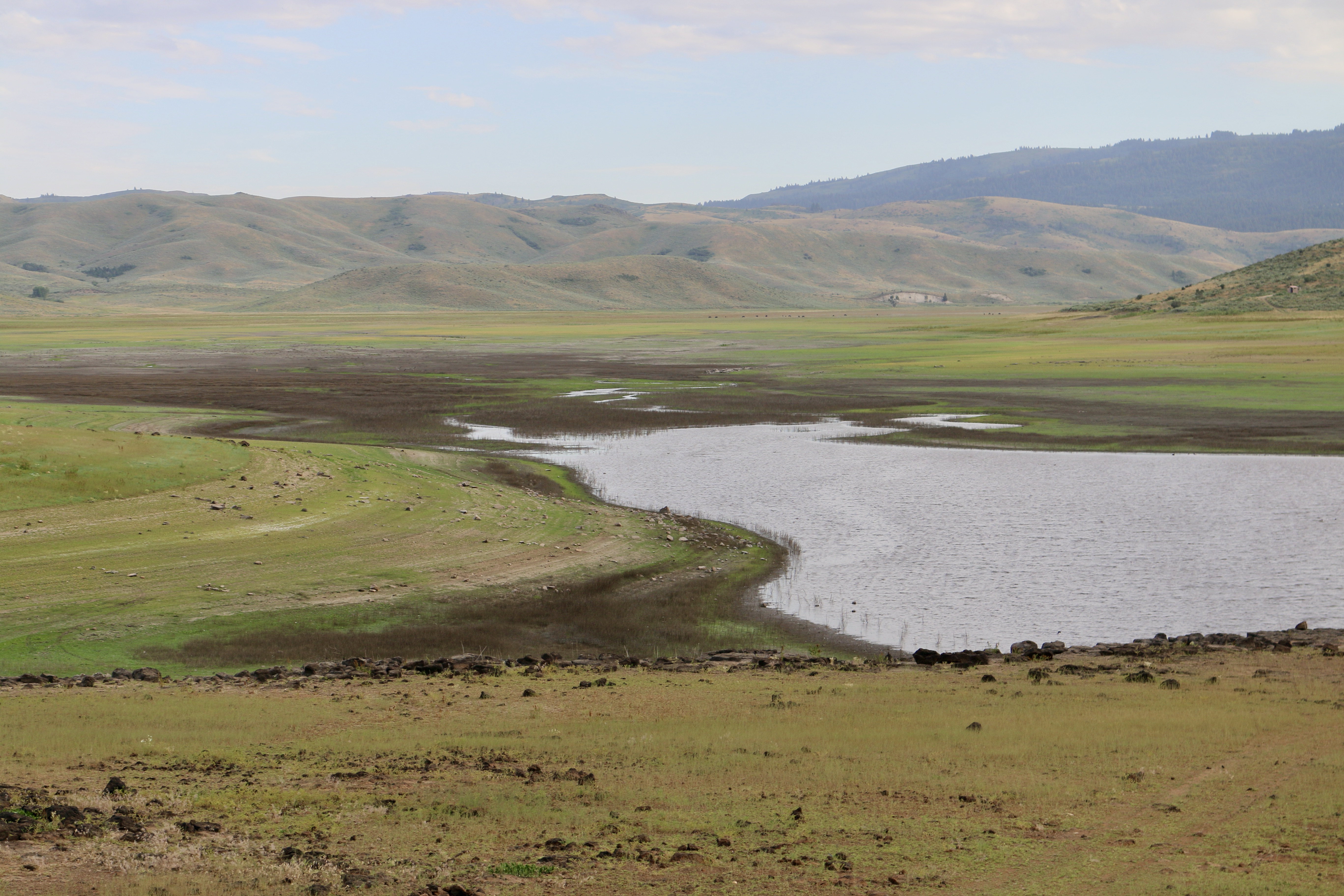
When we talk about the water year in Idaho, that’s really the year we’re looking at for water supply, and that starts at the beginning of October, which is when snow begins to accumulate in the mountains. Most of us realize, after having lived in Idaho for quite a while, our summers have very little precip and so we depend on that snow accumulating. And as it melts out of the mountains, and fills the river systems and the reservoirs, that becomes our water supply for the year. The water year starts on October 1st and ends on September 30th.
In order to understand where we’re at this year, we need to look back in time a little bit. If you all remember, we had 2017 which was the snowpocalypse. We had no drought for the most part in 2019. In 2020, the Northwest began to be impacted by drought, but Idaho mostly avoided it, except on the Big Word and Big Lost rivers in that region. Then in 2021, we had a pretty good snowpack in the mountains, but then we had the driest spring on record since 1924 and that really turned the colors dark red across the Pacific Northwest. The Palouse and northern Idaho was particularly hard hit. Thankfully, because we were coming out of a period of good water supply, the reservoir system was pretty strong in 2021 and it helped pull us through that drought year. If you go to 2022, we had a lot less snow in the mountains in 2022, but we had this really wet and cold spring and that really helped get us through the year. On the western side of the state and the Boise Basin, we actually recovered from drought and add a little extra carryover at the end of the year.
So that brings us to where we’re at now. This spring and this winter, we had a continuous system of storms coming in to the state, especially in the south, and so the southern part of the state is recovered from drought. But the rest of the Pacific Northwest is in drought, and northern Idaho is seeing some really low runoff conditions or streamflow conditions.
IR:
Idaho Department of Water Resources hydrologist Dennis Owsley gave a snapshot of the groundwater in the different aquifers across the state.
Owsley:
Okay, let’s start talking about aquifers. We’re going to start in north Idaho and then work down. There’s three basins: the Rathdrum, Moscow, and Lewiston. Let’s first start on the Rathdrum Prairie aquifer. This is the second largest aquifer we have in the state, and it’s a sole source aquifer. It provides water to over half a million people. The majority of those people live on the western side of the state line, which is Spokane and the Spokane Valley. This water discharges into the Spokane Valley where they use it for potable water source. We have a model built for this area. It is a sole source aquifer because it’s the only potable water source for that area. All the communities rely on this aquifer for their drinking water source, as well as there is some farmland down around the Rathdrum area for agriculture. In general, the precipitation and the contribution from the lakes up here allow the aquifer to create stable aquifer conditions. You can see the last few years in this record, it goes from 1970 to today, and we have a few dips in the downward trend of that hydrograph. Like David said, the last couple of years up in northern Idaho have been a little drier than than usual, but in general, the water levels are doing fine in the Rathdrum prairie.
If we move 80 miles down to the Moscow basin, here we have two aquifers: a shallow and a deep. The shallow system is primarily used by the domestic users, and the deep system is used by the University of Idaho, city of Moscow, WSU and Pullman. There’s a lot of use going on in the deep system, and unfortunately it’s been in a declining pattern since the early 1970s. This is a hydrograph from a monitoring well that we drilled up there, and it only goes back to 2006 when we drilled the well, but you can see there’s a distinct downward trend. And this, again, has been occurring since the 1970s. Unfortunately, this is not a groundwater management area. There’s been a ton of research done on this aquifer with both universities being up there, but unfortunately there’s just not a lot of surface water to recharge this aquifer. There’s a lot of dry land farming that grows world class wheat up there, but the precipitation is locked up in that good soil and used for farming, so the recharge to this system is very limited. So, more work needs to be done in Moscow.
Lewiston. If we jump down 30 more miles to the Lewiston area, we have the Clearwater River flowing east to west and then it merges with the Snake River here by Lewiston. This is a very, very complicated aquifer system. There’s multiple layers that interact with different things. We’re seeing declines in pretty much all the different layers throughout this basin. There’s been some recent work going on up there, and it sounds like the new ideas may be to look at surface water rather than groundwater as a sustainable water resource up here.
I’m going to talk about the Treasure Valley and Mountain Home in more detail, but I wanted to point out that we have a management area down here in the Bruneau-Grand View area, where we have a deep geothermal aquifer system that’s been in decline for some time. We have a Blue Gulch critical area over here along the Swan Falls track. We had seriously declining wells in the 70s. Management efforts were imposed and the aquifer trends are doing much better down here. And then, you can see all the dots we have up in what we call the west-central area. It goes up Highway 95 and down Highway 55. We know development is occurring in these areas, and we would like to have some sort of baseline information to allow managers and decision makers to make the right decisions with regards to the water resources. Even though we don’t see problems now, it’s good to have the data.
The Treasure Valley and Mountain Home. Let’s start with the Treasure Valley, where we are here today. It is a basin full of sediments. It’s a very complicated basin, full of sediments. It sounds really simple, but it’s not. There’s many, many layers of sand, silt and clay. Mostly clay. In addition to a complicated hydrogeologic setting, we have three awesome reservoirs. We have Lucky Peak, Arrowrock, and Anderson. I point those out because they are critically important to what’s happening with our groundwater resources. Every year this valley is flooded through surface water diversions from those reservoirs, and it has been for over 100 years now. We have wells in this valley that just naturally flow. You don’t have to put a pump in them, water just flows out. Those mainly occur along the Boise River from about Eagle downstream, and then we have an area south of Napa that also we see artesian conditions. But as you can see, I don’t even have to put the canals on this map and you can kind of see where the groundwater has been mounded up over the over the course of flooding this valley out every year. We’ve just recently built a groundwater flow model for this basin, and it hopefully is going to answer everyone’s questions regarding management. But in general – and I’m going to say in general as my weasel word here – aquifer levels are doing pretty stable in the Treasure Valley. We have seen some areas south of town where there are declines, but that’s kind of expected. Surface water has never been diverted out here. Just north of Eagle is also an area of some shallow, persistent declines.
Okay, let’s move east a little bit down to the Mountain Home plateau. This is a map of the change in water level. This is not depth of water, but this is how much the water level has changed in the last 20 years. It goes over 112 feet, and then we have one particular well that’s stable or rising, but all the rest of them are declines. Again, it’s 100 feet in the last 20 years. That’s rather significant. I just want to point out that the water levels were fairly stable and fairly close to one another back when the monitoring began, but then as the groundwater development occurred, the water levels have responded significantly. Similar to Moscow, we just don’t have a lot of surface water out here to recharge the aquifer, and so it can easily be over pumped. It’s rather significant. We have the Mountain Home Air Force Base down here, the city of Mountain Home, and then again all the farming that’s going on out in the Cinder Cone area. We have an ongoing study. We’re drilling some new monitoring wells and trying to collect as much information as we can to help provide a potential solution.
Okay, that’s going to conclude the Western region. Now, we’re going to move to our final regions, which are the southern and eastern regions. There is a lot going on over here. We don’t have time to talk about them all. I just wanted to point out a couple of the other areas that we have work going on. We have a critical groundwater area down here in the Curlew Valley. There’s Malad, the Bear River which David mentioned, and I’ll talk about Oakley. And then again, the tributary basins of the Eastern Snake Plain aquifer are important because they provide water to that aquifer, and we need to know how much is coming into the aquifer. We have a lot of work going on up in the Lemhi and Pahsimeroi basins. Those are efforts related to the salmon recovery acts up there. So, as you can see, we have a lot of monitoring going on.
We’re going to start with one basin on the north side. This is the Wood River Basin. It’s a fluvial aquifer up through this portion, it’s just directly related to snowmelt and river runoff. But as you move down to the the Bellevue Triangle there’s a deeper for system that exists down here. This aquifer is very important, not only for the farmers that pump out of it, but it also discharges to Magic Reservoir and Silver Creek right here, and both of those surface water features are fully allocated and people use the water downstream. It’s important to see the contribution from this aquifer to these surface water features. The change map here ranges from where the reds are only four feet, and then we see a couple of areas of decline of a foot. And you may think to yourself, ‘Well, we just saw Mountain Home that declined 100 feet. What is four feet really? How is that important?’ But if you look at the correlation, four feet of an aquifer level over here will correlate to tens or twenties of feet of discharge in surface water over here. I think for this particular well, it’s about 20 cfs per foot of decline in that aquifer, so that’s why it’s really important to regulate the groundwater resources in this particular basin, to help stabilize or maybe increase the flows in Silver Creek and Magic Reservoir. Unfortunately for the farmers out on the Camas, it appears that the same kind of conditions are occurring over here with Magic Reservoir and their aquifer.
Let’s move one basin to the east. This is the Big Lost River. This basin has probably created more headache for the department than many of the basins. We have our own rules to regulate how water is managed in this basin, that’s how interesting it is, and it has had problems over the past. This is the largest tributary basin to the Eastern Snake Plain aquifer. Mackay Reservoir is up here, and the towns of Mackey, Moore, and Arco down here. Water flows down and then discharges into the Snake River Plain. In the last ten years, we’ve seen declines in all the wells, but from about Moore downstream is where we have really, really serious water level decline issues. The river and the aquifer in this basin are directly connected, so it’s important to try to keep the river flowing as well as keep the aquifer stable. I’ll show you a historic hydrograph here that goes back to the forties, this is a great record of what’s happening up here, and I added a blue shaded area on this graph that represents when water was flowing at Arco. So, that means the river was flowing all the way down through at least down to Arco. That is rather significant, as you can see in the aquifer conditions. So after that 2017-18 good winter that we had, and the river was connected for two or three years after, two years afterwards, and you can see the aquifer responded 30 or 40 feet just from those that one season. So you can see kind of the history here. We had the flood irrigation going on which helped keep the river flowing for a long time, and then as sprinklers became more and more common, pumping became more and more common, and the river was able to break. Now we’re in these situations where it’s only flowing on really good water years, versus historically it would flow all the time.
All right. Let’s jump across the entire Eastern Snake Plain to one of the tributary basins. This is going to be the Raft River. We’re going to look at this one. This is one of the oldest critical groundwater areas we have in the state. This is another change map that’s showing declines from 70 feet to a rise of 17 feet. There’s not many good features to point out, but if you know the basin at all, the town of Malta is right there. But the Raft River is not a very big river, and it usually does not flow all the way out to the Snake River. Again, all the agricultural development up here is through groundwater, and the hydrograph is representative of what happens when we just pump the aquifer and it doesn’t get a lot of recharge. It’s not as bad as Mountain Home, but again, it’s not a good situation and it’s been going on since the 50s.
Let’s move one basin over, and this one’s a little bit better, fortunately for us. I know at least one person has some interest in this basin, this is the Oakley basin. It is a critical groundwater area. You’ll see that we have blue and red on this map, which is pretty cool. This is the reason I wanted to add this basin, because it kind of shows some positive results of some management efforts. Again, the changes are from 84 feet of decline to, I think that says 79 feet of a rise, which is cool to see a rise. We have groundwater management efforts going on in this area where they’re importing Snake River water and injecting it into wells and then sending it down into the aquifer through that. If we look at a hydrograph, you can see the the result of the management work that’s going on down here. We have fairly stable if not rising water levels through the 60s, and then they start to tank out for a while. Then about here is where the the injection well work started occurring, and you can see the response in the hydrograph. It is bringing it back up to where it was. So, this is a nice positive note put into a pretty gloomy presentation. There is hope, that’s the goal or the pointed of that.
Finally, the one that probably everyone wants to hear about the most is the Eastern Snake Plain aquifer. This is our largest aquifer – by volume, by legal issues, by economic driver to the state. It is by far our most significant aquifer we have in the state. If you’re not familiar with the Eastern Snake Plain aquifer, these are all the tributary basins feeding to it, and it generally flows from up near Yellowstone down to where it discharges in the Thousand Springs complex between Twin Falls and Hagerman. All the water flows down this way, discharges here into the Snake River, and then downstream. Millions of acres are irrigated on this aquifer through this water. Again, all the cities on this map rely on this water. I can’t emphasize how important this aquifer is for the state. The goal this year was to measure every one of these wells in the first two weeks of April. Unfortunately for us, we had a robust – well, fortunately and unfortunately, we had a lot of snow this year and it made it extremely challenging. We were only able to get basically from about Burley downstream done in those first two weeks, and the rest of the plain fell into the final two weeks. The only reason I tell you that is because of most of the snow that fell this winter was still on the ground or up in the mountains when we measured these wells to make this change map. So, I am very hopeful that next year when you see Mike’s change map, it will be more reflective of this wet winter we had this last year, and we should see more more greens on this map. The Eastern Snake Plain was flooded through the development of canals and flood irrigation. The aquifer and the springs responded up until the 1950s, when power became readily available. In the 1950s, wells started being drilled. More efficient irrigation practices began to occur and have been occurring ever since, and you can see the aquifer and the spring discharges have responded through the change in irrigation practices. Here we are today, and we’re down into getting close to historic conditions. You can see the good winter we had in 2017-18 got us a little bit of a blip there, but without that, we may be approaching a new era of low water levels.
IR:
This information in much more detail is available on the Idaho Department of Water Resources website at idwr.idaho.gov under the Water Data tab.
Bedke:
We envision this statewide summit to morph into regional summits where you can get and drill down into the granular level of all of all of this data as we go forward.

Logan Finney | Producer
Logan Finney is a North Idaho native with a passion for media production and boring government meetings. He grew up skiing, hunting and hiking in the mountains of Bonner County and has maintained a lifelong interest in the state’s geography, history and politics. Logan joined the Idaho Reports team in 2020 as a legislative session intern and stayed to cover the COVID-19 pandemic. He was hired as an associate producer in 2021 and they haven’t been able to get rid of him since.